Geography

The Indian Himalaya do not present themselves as one unbroken chain, but rather as a gigantic layer cake made up of several different ranges. The principal Himalayan mountain ranges divide the Indian Sub-continent from the Tibetan Plateau. From Nanga Parbat in the west, these mountains stretch for over 2000 kilometres to the borders of Sikkim and Bhutan in the east. In Kashmir, the mountain ranges give way to the subsidiary ranges that make up the heart of Kashmir’s lakes and valleys, whilst to the north and east lie Zanskar and Ladakh, commonly referred to as the Trans-Himalaya zone, marking the geological transition between the Indian Sub-continent and the Tibetan Plateau. To the south-east stretch the lower ranges of the Pir Panjal and the Dhaula Dhar which eventually tie in to the high, snow-capped mountains of the Garhwal Himal and beyond to the most easterly extension of the Indian Himalaya, Nanda Devi, the Kumaon Himalaya and the Panch Chuli Group. Sikkim is one of the newest of India’s states, and lies to the east of Nepal, a projection northwards from the Indian plains, and isolated from the surrounding countries (Nepal,Bhutan and Tibet) by high ridges.
Time Zone :
The time in India is GMT +5:30 hours.
Climate :
Many of India’s mountain areas are affected to a certain degree by the monsoon, during the period from June to mid September. However, Ladakh and Zanskar lie in the rain shadow of the Himalaya and escape the worst of the monsoon’s influence, which is why we are able to run our Markha Valley, Spiti to Ladakh, Stok Kangri and Five Passes of Rupshu trips during this period. This area is referred to as a high altitude desert. The part of the Indian Himalaya which encompasses the Vale of Kashmir and Manali has a modified monsoon climate and normally experiences periods of rainfall until mid-July. The Dhaula Dhar Range, the Garhwal, and eastwards to the massifs of Nanda Devi and Panch Chuli, tends to get the main brunt of the monsoon weather, which is why we delay our treks to this region until the end of September when the area normally gets its most settled and pleasant weather in the higher valleys. Similarly, Sikkim is adversely affected by the monsoon, and we run our trips in to the south and east sides of Kangchenjunga on either side of the monsoon - in April and November.
Customs, Religion & Dress :
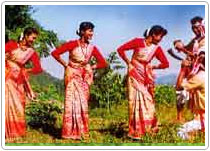 India is a politically secular country of immense cultural variety. The majority population is Hindu and this is the case for the inhabitants of the Himalayan foothill regions of Darjeeeling, the Garhwal and Kumaon. North of the main Himalaya range in Ladakh and Zanskar, and in the former independent kingdom of Sikkim, the people are Bhuddists practicing a Tibetan form of the religion. A fundamental tenet of Bhuddism and Hinduism is the cycle of death and rebirth. Both beliefs have at their heart the concept of ‘karma’ whereby actions in this life effect the quality of rebirth in the next. It is normally quite acceptable to enter Hindu shrines and Bhuddist temples and indeed these are a fascinating part of any visit to the region. Visitors should be respectful of local customs and it is a good idea to observe how local people behave when in these shrines. In particular you should be aware that the cow is a sacred animal to Hindus and in general you should not wear leather items (especially boots) when entering a Hindu shrine or temple. The Himalayas is a sacred area to both Hindus and Bhuddists and this is especially so of the Gharwal, the source of the holy river Ganga or Ganges. On treks to the Garhwal and neighbouring Kumaon you should be discreet when drinking alcohol, particularly in hotels and public places. Indians do not normally display their legs (except low caste Hindus). When trekking above villages it is fine to wear shorts but it is a good idea to carry long pants or a skirt so that you are appropriately dressed when passing through towns or villages. When in doubt you should seek the advice of your trip leader. India is a politically secular country of immense cultural variety. The majority population is Hindu and this is the case for the inhabitants of the Himalayan foothill regions of Darjeeeling, the Garhwal and Kumaon. North of the main Himalaya range in Ladakh and Zanskar, and in the former independent kingdom of Sikkim, the people are Bhuddists practicing a Tibetan form of the religion. A fundamental tenet of Bhuddism and Hinduism is the cycle of death and rebirth. Both beliefs have at their heart the concept of ‘karma’ whereby actions in this life effect the quality of rebirth in the next. It is normally quite acceptable to enter Hindu shrines and Bhuddist temples and indeed these are a fascinating part of any visit to the region. Visitors should be respectful of local customs and it is a good idea to observe how local people behave when in these shrines. In particular you should be aware that the cow is a sacred animal to Hindus and in general you should not wear leather items (especially boots) when entering a Hindu shrine or temple. The Himalayas is a sacred area to both Hindus and Bhuddists and this is especially so of the Gharwal, the source of the holy river Ganga or Ganges. On treks to the Garhwal and neighbouring Kumaon you should be discreet when drinking alcohol, particularly in hotels and public places. Indians do not normally display their legs (except low caste Hindus). When trekking above villages it is fine to wear shorts but it is a good idea to carry long pants or a skirt so that you are appropriately dressed when passing through towns or villages. When in doubt you should seek the advice of your trip leader.
Currency :
India’s unit of currency is the Rupee. It is not necessary to purchase Indian currency before you go. Money can be changed at a reasonable rate at your hotel. Since you will be changing the majority of your spending money into local currency on the first day of arrival we recommend taking this in cash. Both Dollars and Sterling are readily exchanged in Delhi. If you plan on buying expensive souvenirs on your return to Delhi it is worth considering taking money for this in travellers cheques. Credit cards can be used to purchase many goods in Delhi and are particularly useful for more expensive items such as carpets. It is possible to withdraw cash (rupees only) from cash machines in certain banks in Delhi using credit and debit cards, and often this will be at the most favourable exchange rate.
Visas :
All nationalities need to obtain a visa for entry into India. Rates vary depending on your nationality. Full details of current rates and the visa application process will be sent on when we confirm your booking on a TBI trip. Plenty of time should be allowed to obtain your Indian visa if you are intending to apply for it by post. Applications usually take two to three weeks to process. Another option is to hand in your passport at an Indian Embassy in person, which will often then be processed overnight for you to collect next day.
Vaccinations :
You should visit your own doctor and dentist for a check-up prior to taking your trip to India.
The following is a Rough Guide for immunisation : (We must stress that this is only a basic guide - and you must abide by the advice of your local doctor/medical professional).
(a) Polio (normally you will just need a booster.)
(b) Tetanus.
(c) Typhoid. A full course requires 2 injections separated by an interval of 4-6 weeks.
(d) Hepatitis (A) and (B).
(e) Anti-malarial prophylaxis: Please refer to your doctor for the most up to date information about anti-malarial medication for the areas that you will be visiting.
(f) Rabies pre-exposure vaccination. Please refer to your doctor for advice on whether you need rabies pre-exposure vaccination. In the unlikely case of your being bitten, this vaccination does not eliminate the need for urgent evacuation to a suitable medical facility for additional treatment,. However, it does simplify that additional treatment and also prolongs the period that you can safely delay before receiving post-exposure treatment.
Given enough notice, your doctor will be able to administer all the above vaccinations.
Drinking water
Do not drink the tap water anywhere in India. At the Hotel Imperial in Delhi the filtered water in rooms and restaurants is safe, and bottled water is available in all major hotels, restaurants and shops. In general water other than bottled water in restaurants should be avoided. If in doubt ask your trip leader who will know where it is safe.
Additional Source of Information :
Books
India. A Travel Survival Kit. Crowther. Lonely Planet
Trekking in Pakistan and India. Hugh Swift
Ladakh and Zanskar. Artou and Chabloz
Kashmir, Ladakh and Zanskar. Schettler. Lonely Planet
Trekking in the Indian Himalaya. Weare
Where Men and Mountains Meet. John Keay
Painted Mountains. Steven Venables
Slowly Down the Ganges. Eric Newby
The Everest Years. Bonington
Thin Air. Greg Child
Kulu - The End of the Habitable World. Penelope Chetwode
Ladakh - Crossroads of High Asia. Janet Rizvi
Ancient Futures - Learning from Ladakh. Helena Norberg-Hodge
No Place to Fall. Victor Saunders
Elusive Summits. Victor Saunders
Exploring the Hidden Himalaya. Kapadia and Mehta
Maps
RGS. The Mountains of Central Asia. 1:300,000 Gazetteer
Artou Trekking Map to Ladakh and Zanskar. 1:350,000
AMS “U-502” Series 1:250,000
NI-43-8 - Ladakh, Leh.
NI-43-12 - Ladakh, Martselang.
NI-43-11 - Trans Himalaya, Anantnag.
NH-44-5 - Gangotri, Dehra Dun.
NG-45-3 - Kangchenjunga - East Side of Sikkim.
NG-45-4 - Phari Dzong - West Side of Sikkim
Sikkim Himalaya (Swiss Map) Schweiz. Stiftung Fur Alpine Forschungen 1:150,000 (excellent map - but hard to find).
Leomann Maps produce a range of trekking maps which cover Jammu and Kashmir, Himachal Pradesh and Uttar Pradesh. Internet
Lonely PLanet - www.lonelyplanet.com
Rough Guides - www.roughguides.com
|